
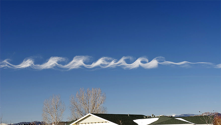
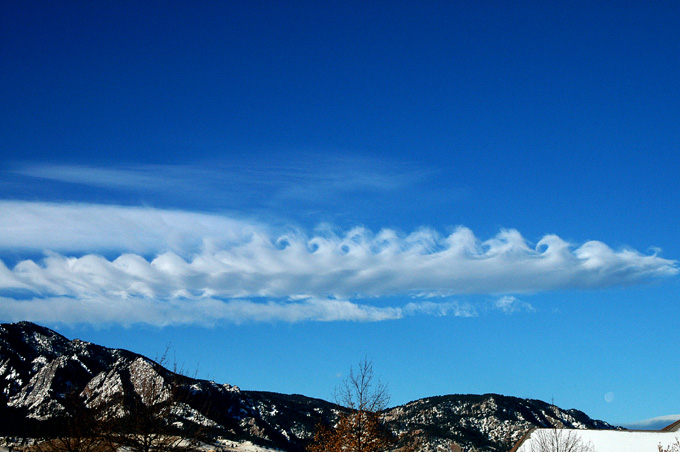
"A Kelvin-Helmholtz instability forms where there's a velocity difference across the interface between two fluids: for example, wind blowing over water. You’ll often see the characteristic wave structure in this type of cloud when two different layers of air in our atmosphere are moving at different speeds. The upper layers of air are moving at higher speeds and will often scoop the top of the cloud layer into these wave-like rolling structures.
The clouds often form on windy days, when there’s a difference in densities of the air, for example, during a temperature inversion. They’re often good indicators of atmospheric instability and the presence of turbulence for aircraft."
https://www.aol.com/article/news/2019/06/19/what-are-kelvin-helmholtz-clouds-rare-formation-spotted-over-virginia-mountain/23752865/


 Re: Kelvin Helmholtz Wave Clouds


"Almost" Good Answers: